Defining the best area to project a wellfield in Caçapava - SP, Brazil
Implementation of a wellfield in Caçapava - SP, Brazil. This was planned with its constructive parameters in the best hydrogeologic area defined using public data. The aim of this project is to meet the demand of a possible abrupt population growth of 20,000 people.
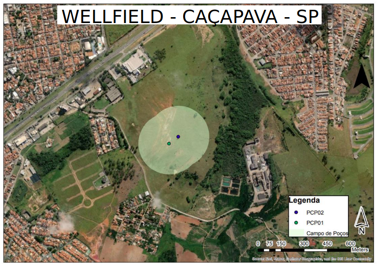
Wellfield position with the protected area (light green area) and wells (blue and green dots).
Skills and Tools Used
- Analysis of hydrogeologic data.
- Pumping test data analysis.
- Groundwater recharge calculation.
- Python.
- ArcGIS.
- Google Earth Engine Python API.
This project was designed and carried out with the collaboration of Cleilson Gama. This page briefly summarizes the work done to achieve the goal of the project.
Objectives
Implementation of a wellfield with its constructive parameters in the municipality of Caçapava to meet the demand of possible abrupt population growth of 20 thousand people. As well as define the best area to construct the wellfield. The objective was reached by doing:
- Study of the Caçapava geologic/hydrogeologic context.
- Collect of public hydrogeologic data.
- Maps making: aquifer thickness, water static level, specific capacity, etc.
- Transmissivity calculation by using empiral relationship with specific capacity.
- Define the best transmissivity region.
- Study of contamined areas.
- Define the well pump motor, drilling method, well casing and filter pack.
- Define the well quantity and the distance by calculating the interference between by using Theis equation.
- Operational control and preventive maintenance planning.
- Project total cost for a 25 years of production.
- Groundwater recharge calculation and environmental feasibility study.
Study of the Caçapava geologic/hydrogeologic context.
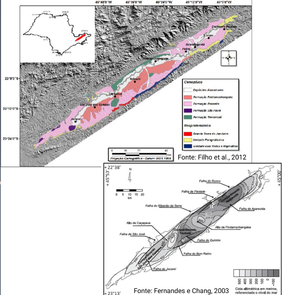
Caçapava is located in a Cenozoic rift basin. In this municipality, there is a high of bedrock. The aquifer is majority unconfined and has a heterogeneous character and is defined as a large thick sandstone. Transmissivity values found in the literature range between 1.2E-04 and 9.5E-03 m2/s.
Collect of public hydrogeologic data and maps making.
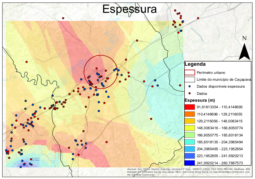
Aquifer thickness map. This was done by using Ordinary Kriging in the available public data (dots). The red circle represents the urban area of Caçapava. This map is one example of the total maps produced to support the decision-making.
Transmissivity calculation by using empiral relationship with specific capacity.
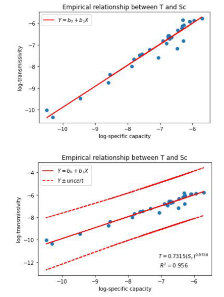
The procedure applied to estimate the transmissivity values can be viewed in this notebook in the github repo.
Define the best transmissivity region.
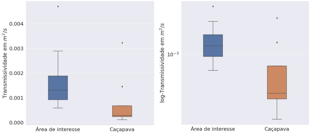
Distribution of the transmissivity data for the area of interest (left hand side boxplot) against transmissivity data of the Caçapava.
Study of contamined areas.
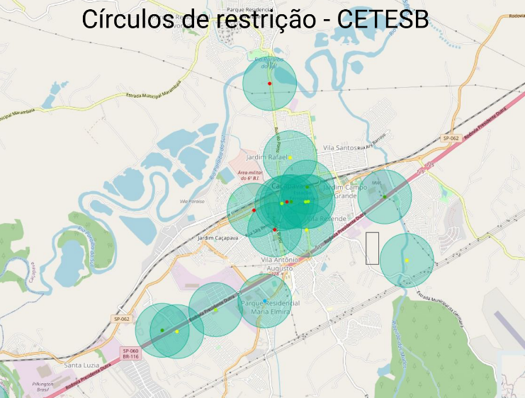
Data of contamined areas collected. The green circles is contamined areas. The black rectangle represent the area of interest to construct the wellfield.
Define the well pump motor, drilling method, well casing and filter pack.
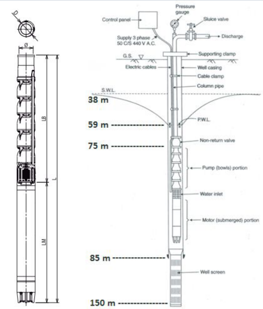
The water pump is a EBARA BHSE 8105-02. Water pump of 8'', 35HP, and 26.1kW. Galvanized well casing 8''. The water pump motor will be located between 75 and 85 meters in depth. The well was planned to have large diameter boring with grout seal and gravel pack along the well screen.
Define the well quantity and the distance by calculating the interference between by using Theis equation.
The interference and distance between the wells were calculated using the Theis solution and Jacob drawdown correction for unconfined aquifers using the available data.
Project total cost for a 25 years of production.
The project to work for 25 years has a total cost of 13,910,000 BRL. This cost accounts for the drilling, construction, water well pumps, maintenance costs, energy for 25 years, and the price to buy the place.
Groundwater recharge calculation and environmental feasibility study.
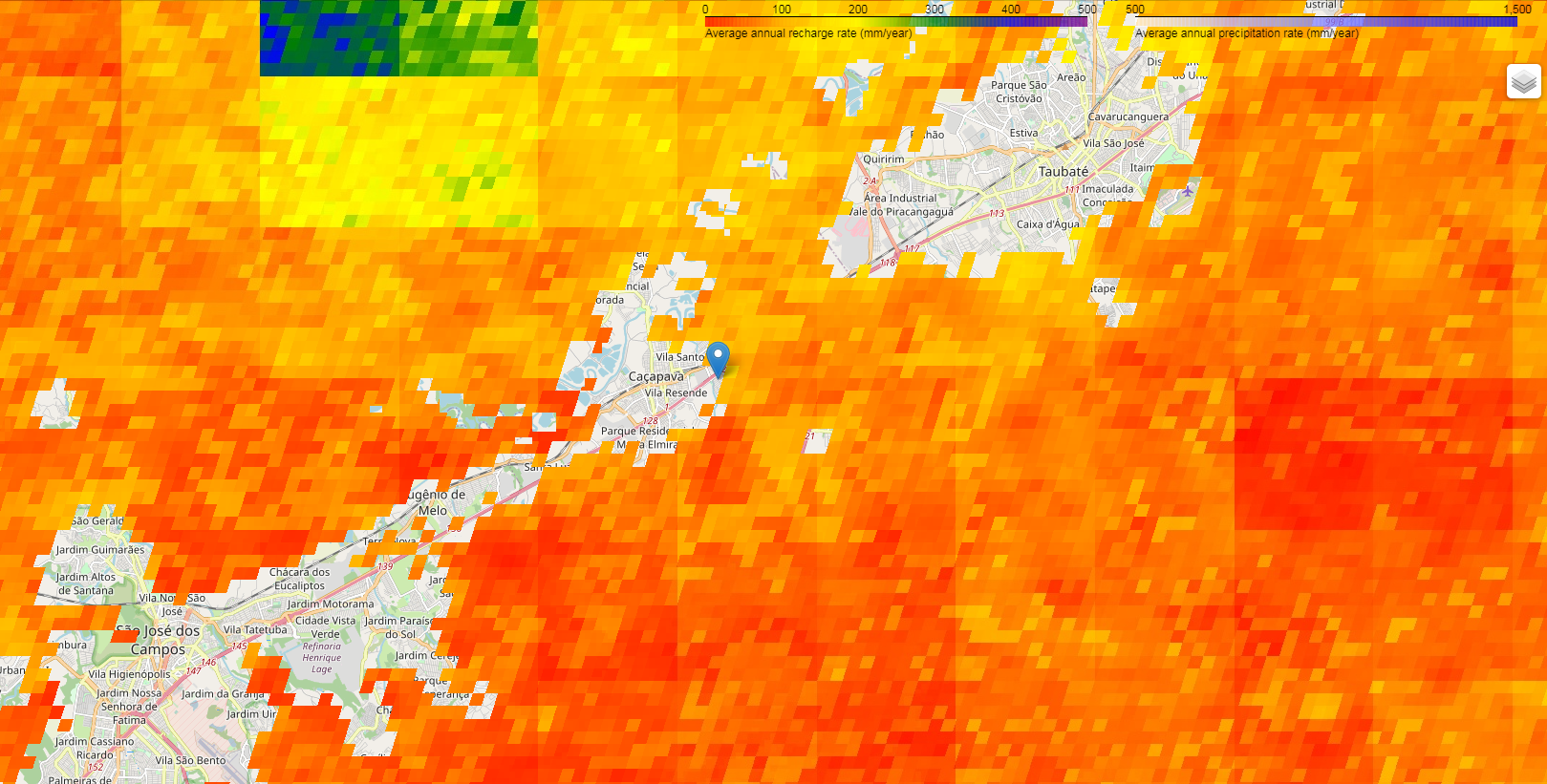
The groundwater recharge were calculated using the Thornthwaite-Matter Procedure and Google Earth Engine. It can be viewed in this notebook. This study showed that the wellfield will not over exploit the aquifer.